
If you are researching how 3D laser scanning works for existing buildings, the short answer is simple: a scanner captures millions of measured points from the job site, software aligns that data, and drafters turn it into usable as-built drawings or models. For homeowners, architects, contractors, and commercial property teams in California, that process can save time and reduce guesswork when accurate existing conditions matter.
What matters most is not just the scanning device itself, but the full scan workflow behind it. Good as-builts depend on careful field coverage, clean registration, and experienced drafting. At FastAsBuilt, we provide field-measured as-built drawings and measured floor plans across California using on-site measurement and senior drafters to produce permit-ready CAD files in PDF and DWG formats. If you want a broader overview of deliverables, see what is typically included in as-built drawings.
What 3D laser scanning actually does
To understand how laser scanning works, start with the basic result: the scanner records the shape and location of surfaces around it. Walls, doors, windows, ceilings, columns, stairs, beams, and other visible building elements are captured as dense spatial data. That data is commonly called a point cloud.
Each point represents a measured location in space. When enough points are captured, the scanner creates a highly detailed digital record of existing conditions. Instead of relying on a few spot dimensions taken by hand, the team can review a much richer picture of the site.
For as-builts, the scanner is not the final product. The final product is usually a set of readable plans, elevations, sections, and sometimes a 3D model. The scan is the measurement foundation that supports those deliverables. If you are comparing methods, you may also want to read about laser scanning versus tape measuring for as-builts.
How the scanner captures a building on site
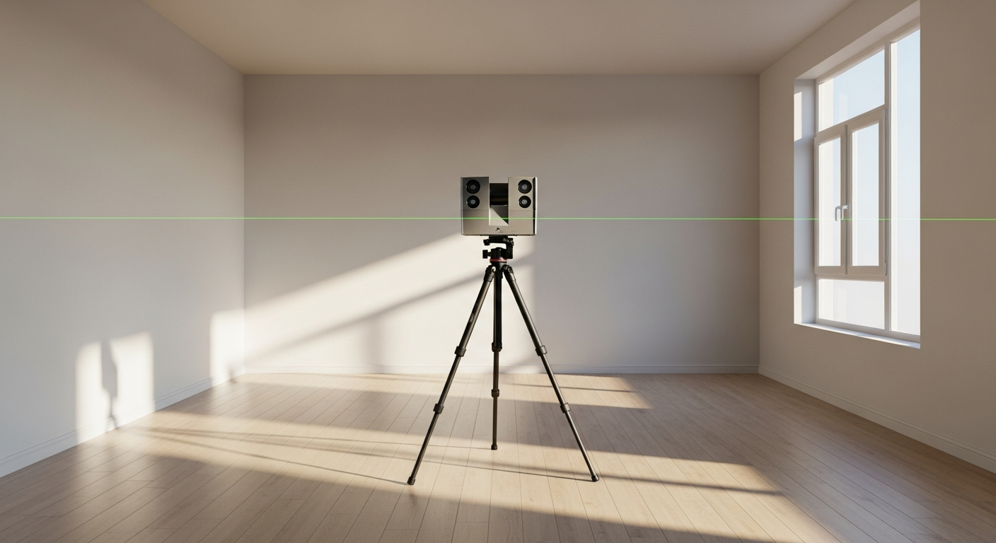
The field portion of the scanning process begins with a site visit. The technician moves through the building and places the scanner at multiple positions so it can see different parts of the space. One scan position cannot capture everything because walls, furniture, millwork, and corners block lines of sight. That is why overlapping scan locations are essential.
At each setup, the scanner measures visible surfaces across the room. Depending on the project, the team may capture:
- Interior rooms and circulation areas
- Exterior walls and openings
- Ceiling heights and soffits
- Structural elements such as columns and beams
- Stairs, railings, and landings
- Mechanical rooms or utility areas when access is available
The goal is complete enough coverage to support drafting later. For a house, that may mean scanning room by room. For a commercial property, it may include suites, lobbies, service corridors, and exterior conditions. In California, access and occupancy conditions often shape the field plan, especially in busy tenant spaces or lived-in homes.
Need accurate as-built plans?
FastAsBuilt sends a local crew to laser-measure your property and delivers permit-ready 2D or 3D drawings, starting at $900.
See 2D & 3D pricingWhy multiple scan positions are necessary
People often assume the scanner works like a camera that can grab the whole building at once. In practice, scanning is more like assembling a complete record from many measured viewpoints. Every time the instrument moves, it captures the environment from a new angle. Those separate captures later get connected together.
This matters because real buildings are full of obstructions. Cabinets hide wall segments. Open doors can block corners. Furniture can obscure base conditions. Exterior vegetation may partially hide facades. By planning enough setups, the field team reduces blind spots and improves the final dataset.
A good scan workflow also includes practical judgment about what needs to be captured for the intended use. A permit set for renovation may require stronger attention to openings, wall layouts, and vertical relationships than a simple marketing floor plan. That is one reason project scope should be clear before fieldwork begins.
What registration means in the scan workflow
After the site is captured, the next major step is registration. Registration is the process of aligning all the individual scans into one coordinated dataset. In plain terms, software and technician review are used to determine how scan position A matches scan position B, C, D, and so on until the building fits together correctly.
This is one of the most important parts of how 3D laser scanning works. If registration is poor, the point cloud can drift, walls may not line up properly, and downstream drawings can become unreliable. If registration is done well, the result is a coherent digital record that can be checked, sliced, measured, and drafted from multiple views.
Registration usually depends on overlap between scan locations. The system identifies common geometry seen from different positions and uses that shared information to align the scans. Then the technician reviews the result and checks for obvious errors before the drafting phase begins.

How point clouds become plans, elevations, and sections
Once registration is complete, the scan data becomes a drafting reference rather than the end goal. Senior drafters review the point cloud and translate it into organized CAD deliverables. This is where raw measured data becomes something that architects, designers, contractors, and plan check teams can actually use.
Typical outputs may include:
- 2D floor plans showing room layout, wall locations, doors, and windows
- Exterior elevations based on captured building faces
- Building sections that show vertical relationships
- A 3D model for projects that need more coordination
- Permit-ready CAD files in PDF and DWG formats
At FastAsBuilt, our method combines on-site measurement with senior drafting review so the final documents are clear and practical. That distinction matters. A point cloud by itself is not the same as a finished as-built package. If you want to see the broader production process, read how as-built drawings are made.
Where scanning fits into as-built services in California
Not every project needs the same level of deliverables. Some clients need straightforward 2D plans to document an existing house, tenant suite, or small commercial space. Others need a more detailed 3D package for renovation planning, design coordination, or complex conditions.
FastAsBuilt offers field-measured as-built drawings and measured floor plans across California, with local crews serving Southern California, the Bay Area, and San Diego. Our 2D As-Built Plans start at $900 for up to 1,500 square feet, then $0.50 per square foot, include one revision, and typically deliver in 48 to 72 hours. Our 3D As-Built Plans start at $1,500, then $1.00 per square foot, include a 3D model plus 2D floor plans, elevations and sections, include two revisions, and typically deliver in 3 to 5 business days.
Turnaround times are estimates and may vary based on project complexity and scheduling.
Custom projects such as commercial properties, ADUs, SB9 work, and tenant improvements are quoted individually because the scan workflow and drafting needs can vary significantly. If you are pricing options, this guide to as-built drawing costs in California may help, and you can also start an order online.
What affects scan quality and usable results
When people ask how laser scanning works, they often focus on equipment. Equipment matters, but field conditions and workflow discipline matter just as much. Several factors influence whether the data will translate into clean as-built drawings.
Site access
If rooms are locked, blocked, or occupied at key moments, coverage can suffer. Good access planning reduces missed areas and return trips.
Line of sight
Scanners capture what they can see from each setup. Hidden corners and blocked surfaces require additional positions or supplemental measurement.
Project scope
The required deliverable shapes the scan strategy. A simple floor plan needs different emphasis than a full renovation set with sections and elevations.
Drafting interpretation
Even with strong point cloud data, someone still has to interpret the building correctly. Experienced drafters help convert data into readable and consistent plans.
That is why a disciplined workflow matters from field capture through final CAD production. For many clients, the most useful question is not just whether a property can be scanned, but whether the final plans will be complete enough for design, permit, or construction planning.
When 3D laser scanning is especially useful
Scanning is particularly valuable when existing conditions are irregular, large, or hard to document efficiently by hand. California properties often include additions, remodels, sloped sites, mixed occupancies, and older buildings where reliable existing drawings are missing or outdated.
3D scanning can be a strong fit for:
- Homes with multiple remodel phases
- ADU and garage conversion planning
- Tenant improvement projects
- Commercial suites with complex layouts
- Buildings that need elevations and sections in addition to floor plans
- Projects where teams want a digital record before demolition or design
For homeowners, this often answers the practical question of how to get floor plans of an existing house when no reliable plans are on hand. For design professionals, scanning can provide a more dependable existing-conditions base before schematic design begins.

Frequently asked questions
Is a point cloud the same thing as an as-built drawing?
No. A point cloud is measurement data captured from the site. An as-built drawing is a drafted deliverable created from that data and other field information. Most clients need readable plans, elevations, sections, or models rather than raw scan files alone.
Does laser scanning replace all other field measurement?
Not always. Scanning is powerful, but complete as-built work still depends on field judgment and drafting review. Some projects benefit from supplemental checks, notes, or targeted measurements to clarify areas that are obscured, inaccessible, or unusually detailed.
How long does the scanning process take?
The on-site time depends on building size, layout, access, and deliverables. After field capture, the data must be registered, reviewed, and drafted. At FastAsBuilt, typical delivery for 2D As-Built Plans is 48 to 72 hours, while 3D As-Built Plans typically deliver in 3 to 5 business days.
Turnaround times are estimates and may vary based on project complexity and scheduling.
Do I need 2D plans or a 3D as-built package?
That depends on your project goals. If you need a straightforward record of layout and dimensions, 2D plans may be enough. If your project needs a 3D model plus 2D floor plans, elevations, and sections, a 3D as-built package may be the better fit. Custom scopes for commercial work, ADUs, SB9 projects, and tenant improvements are quoted individually.
Start with accurate as-builts
Order field-measured 2D or 3D as-built drawings and let a local crew handle the measuring and drafting.
Get instant pricingBottom line
How 3D laser scanning works is straightforward in principle: capture the building from multiple positions, register the scans into one dataset, and convert that information into usable as-built documents. The real value comes from a reliable scan workflow and experienced drafting that turn field data into permit-ready plans. If you need field-measured as-built drawings or measured floor plans anywhere in California, FastAsBuilt can help.