
3d laser scanning for buildings has become one of the most useful ways to capture existing conditions before design, permitting, renovation, or property planning. If you need reliable information about a home, apartment building, retail suite, office, warehouse, or mixed-use property, a scan can create a detailed digital record of what is actually built in the field—not what old plans say should be there.
In California, that matters. Remodels, ADUs, SB 9 projects, tenant improvements, and permit applications often start with incomplete or outdated drawings. A building scan helps teams reduce guesswork, especially when walls are out of square, additions were made over time, or original records are missing. This guide explains what 3d laser scanning for buildings is, how it compares with traditional measurement, what you get at the end, and how to think about building laser scan cost and project fit.
What 3d laser scanning for buildings actually means
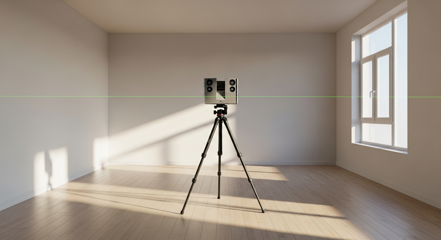
At a practical level, 3d laser scanning for buildings is the process of using specialized equipment to capture the shape and geometry of an existing space. The scanner records millions of measured points from multiple positions throughout the property. Those points are combined into a point cloud, which acts as a highly detailed three-dimensional record of the site.
For owners, architects, contractors, and property managers, the key value is simple: you get a more complete picture of existing conditions than you usually get from rough hand measurements alone. A scan can capture room dimensions, wall locations, ceiling heights, door and window openings, structural elements, stairs, sloped ceilings, and many other features that are important for planning and documentation.
If you are new to the topic, it helps to distinguish between the scan itself and the final drawing set. A scan is raw capture data. Most projects still need drafting, modeling, and interpretation afterward to produce usable deliverables such as floor plans, elevations, sections, reflected ceiling plans, or a BIM model. If you want the broader background on documentation, see what a 3D building scan is and what as-built drawings are.

Why building teams use scanning instead of relying on old plans
Many California properties have a gap between what is on paper and what is in the field. That gap can come from phased construction, undocumented remodels, tenant improvements, aging buildings, or simply poor record keeping. A building scan gives your team a current baseline before design begins.
Common reasons to use scanning include:
- Preparing existing-condition drawings for permits
- Planning renovations, additions, and interior reconfigurations
- Documenting older homes with irregular geometry
- Capturing complex commercial spaces with many rooms or ceilings
- Coordinating architecture, structural, and MEP work
- Reducing return visits caused by missing dimensions
- Creating a digital archive before construction starts
This is especially valuable when a project involves code review, accessibility upgrades, Title 24 coordination, or local planning review. California jurisdictions often want plans that reflect actual existing conditions, and the cleaner that baseline is, the easier it is for the rest of the team to move forward.
That does not mean every property needs scanning. For some straightforward residential work, on-site laser measurement and traditional drafting are still efficient and cost-effective. FastAsBuilt commonly provides field-measured as-built drawings and measured floor plans across California using on-site laser measurement followed by permit-ready CAD drafting. If your project mainly needs 2D permit-ready plans, that can be the right fit without a full scan workflow.
How the scanning process works from site visit to final files
Most building scanning projects follow a similar sequence. The details vary by property type, scope, access, and final deliverables, but the overall path is straightforward.
1. Project scoping
First, the team defines what needs to be captured and what needs to be delivered. A single-family home, a restaurant tenant improvement, and a multistory apartment building all require different levels of detail. The scope should clarify whether you need only a point cloud, 2D plans, elevations, sections, a 3D model, or scan-to-BIM output.
2. On-site capture
The field crew places the scanner in multiple positions throughout the building. Each setup captures a portion of the property, and overlapping views help stitch the data together. Exterior areas can also be captured when needed. Site conditions matter here: furniture, stored materials, locked rooms, active occupants, and lighting do not necessarily stop the process, but they can affect logistics and completeness.
3. Registration and cleanup
After fieldwork, the scan positions are aligned into one coordinated dataset. The result is a point cloud representing the measured building. At this stage, the team may also clean noise, organize files, and verify coverage.
4. Drafting or modeling
Once the point cloud is ready, drafters or modelers use it to produce the final deliverables. This is where raw data becomes useful documentation. Depending on your scope, that may mean 2D CAD floor plans, elevations, sections, a Revit model, or a broader existing-conditions package.
5. Review and revisions
The final step is quality review and client revisions as needed. FastAsBuilt’s 2D As-Built Plans include one revision, and 3D As-Built Plans include two revisions. For many projects, a quick review at this stage catches naming preferences, sheet organization, or a small number of field clarifications.
If you want a deeper explanation of the workflow, see how 3D laser scanning works for as-builts and how as-built drawings are made.
Need accurate as-built plans?
FastAsBuilt sends a local crew to laser-measure your property and delivers permit-ready 2D or 3D drawings, starting at $900.
See 2D & 3D pricingWhat deliverables you can expect from a building scan
One of the biggest misconceptions about 3d laser scanning for buildings is that there is only one output. In reality, scanning can support several types of deliverables, and the right choice depends on what you are trying to do next.
Typical outputs include:
- Point cloud files for design consultants
- 2D floor plans showing walls, openings, fixtures, and dimensions
- Exterior elevations for facade and planning work
- Building sections for height, roof, and volume relationships
- Reflected ceiling information where ceiling conditions matter
- 3D models for coordination and design development
- Scan-to-BIM deliverables for teams working in Revit or similar platforms
For many owners and permit applicants, the immediate need is not the point cloud itself but permit-ready drawings. FastAsBuilt’s standard measured drawing service is built around that need: local crews perform on-site laser measurement, then senior drafters produce permit-ready CAD files in PDF and DWG formats. The 2D As-Built Plan package starts at $900 for up to 1,500 square feet, then $0.50 per square foot, with typical delivery in 48 to 72 hours. The 3D As-Built Plan package starts at $1,500, then $1.00 per square foot, and includes a 3D model plus 2D floor plans, elevations, and sections, with typical delivery in 3 to 5 business days.
Turnaround times are estimates and may vary based on project complexity and scheduling.
For larger commercial properties, ADUs, SB 9 work, and tenant improvements, custom quoting is usually the right approach because the scope can vary widely. If your team is deciding whether you need a model or just drawings, this guide to scan-to-BIM can help frame the difference.
When laser scanning makes the most sense
Laser scanning is especially useful when the property is large, geometrically complex, historically altered, or highly coordination-sensitive. It becomes more valuable as the cost of missing information rises.
Good candidates include:
- Older homes with additions and nonstandard framing
- Multistory residences with stair and roof complexity
- Apartment and condo buildings needing consistent documentation
- Restaurants, medical suites, and retail spaces with dense interiors
- Offices and schools with repeated rooms but complex infrastructure
- Warehouses and industrial spaces with long spans and equipment zones
- Historic properties where accurate existing documentation matters
In California, this often overlaps with real project constraints. An ADU conversion may need precise ceiling heights and window locations. An SB 9 lot split or duplex plan may start with accurate existing structures. A tenant improvement may need dependable base drawings for life-safety planning and consultant coordination. Historic properties under the Mills Act can also benefit from careful existing-condition documentation before preservation work, though you should always confirm local program requirements with the city or county involved.
Scanning is also useful for properties affected by balcony or exterior condition review planning under laws such as SB 721 and SB 326, where teams may need clear building records to organize maintenance or alteration work. The scan is not a substitute for inspection requirements, but it can support documentation and planning. As always, confirm current local enforcement and consultant requirements with the authority having jurisdiction and your design team.
Accuracy, limitations, and what “high detail” really means
People often assume a scan automatically answers every field question. In reality, scan quality depends on equipment, operator skill, site access, line of sight, and how the final drafting or modeling is done. A good scan can be highly accurate, but it still needs experienced interpretation.
Here are the most important practical points:
- Visible surfaces capture best; hidden conditions still require investigation
- Clutter can block parts of walls, floors, or fixtures
- Closed cabinets, ceiling plenums, and concealed framing are not magically revealed
- Exterior bright light, reflective surfaces, and glass can complicate capture
- Final drawing quality depends on drafting standards, not just field hardware
This is why owners should think in terms of “fit for purpose.” If your goal is permit-ready floor plans, you need a scope and drafting standard tailored to permitting. If your goal is clash-aware 3D coordination, you may need a different level of capture and modeling. If your goal is simply verifying a lease space before layout planning, a lighter deliverable may be enough.
For a closer look at tolerances and expectations, review how accurate 3D laser scanning is for as-builts. It is also worth comparing scans with traditional methods in this laser scanning vs. tape measuring guide.
3d laser scanning, LiDAR, Matterport, and photogrammetry compared
Several technologies are often grouped together, but they are not interchangeable. Understanding the differences helps you avoid overbuying or underbuying.
Laser scanning
Best when you need detailed, geometry-focused capture of building conditions for design or documentation. This is the category most people mean when talking about professional 3d laser scanning for buildings.
LiDAR building survey
LiDAR is the underlying distance-measurement method used in many scanning systems. In building work, the phrase “LiDAR building survey” is often used broadly to describe a scan-based existing-conditions survey. If you want a more focused explanation, see what LiDAR scanning for buildings is.
Matterport
Matterport is often used for virtual walkthroughs, visual tours, and simple space capture. It can be useful for marketing, remote review, and some basic documentation, but it is not always the same thing as a full professional as-built survey workflow. Learn more in what a Matterport scan is used for and whether you can make a floor plan from a Matterport scan.
Photogrammetry
Photogrammetry uses overlapping photographs to infer geometry. It can be effective in some applications, especially exteriors, but building interiors and precise as-built needs often favor laser-based methods. For a side-by-side comparison, see laser scanning vs. photogrammetry.
The right choice depends on your end use. If you need permit drawings, code coordination, or detailed renovation planning, start with the deliverable you need and work backward to the capture method.

How to think about building laser scan cost
Building laser scan cost depends less on the buzzword “scan” and more on the full scope of work. The biggest pricing drivers usually include property size, building complexity, occupancy, access restrictions, required deliverables, turnaround time, and whether you need drafting or BIM after capture.
Questions that affect cost include:
- How many square feet need to be documented?
- Is the building simple or highly irregular?
- Do you need interiors only, or exterior elevations too?
- Are there multiple levels, roofs, or hard-to-access areas?
- Do you need only raw capture, or finished permit-ready CAD?
- How fast do you need the files back?
For many California projects, the better budgeting question is not “What does scanning cost by itself?” but “What level of existing-condition documentation do you need?” If your project can be solved with measured as-built drawings, FastAsBuilt’s standard pricing gives a clear starting point. The 2D package starts at $900 for up to 1,500 square feet, then $0.50 per square foot. The 3D package starts at $1,500, then $1.00 per square foot, and includes more complete model-based deliverables. Custom projects are quoted individually.
If you want a wider budgeting discussion beyond scanning alone, see as-built drawings cost in California. For permit-focused work, this permit guide is also useful.
How scanning fits into California permits, remodels, and code-driven projects
California projects often involve more stakeholders and more review layers than owners expect at the start. A good building scan or measured existing-condition package can help align everyone around the same baseline.
Examples include:
- Home remodels where old drawings are missing or inaccurate
- ADU design where ceiling heights, setbacks, and openings must be verified
- SB 9 projects where existing structures affect planning strategy
- Tenant improvements where current conditions drive layout and life-safety work
- Title 24 coordination where building geometry affects energy documentation
- Condo or apartment updates where repeated units still vary in the field
Some California laws and programs also create situations where accurate records are helpful. AB 1033, for example, concerns local authority to allow ADU sales in some cases, which can increase the need for clear unit documentation when local programs adopt it. SB 1211 affects ADU-related parking and development rules in ways that may influence planning for multifamily properties. AB 2533 has also affected certain housing-related processes in California. Because state laws are implemented through local rules and project-specific interpretations, you should always confirm current requirements with your city or county, architect, and permit consultant.
The key point is not that scanning itself satisfies a law. It does not. The value is that better existing-condition information helps the rest of the project team respond to local code, planning, and permit requirements with fewer assumptions.
Choosing the right provider and scope for your project
Not every provider offers the same combination of fieldwork, drafting quality, turnaround, and local experience. Before you hire anyone, define what success looks like for your project.
Ask these questions:
- Do you need permit-ready CAD drawings, a point cloud, or a BIM model?
- Will the provider actually measure on site, or mainly process third-party data?
- Are revisions included?
- What is the typical turnaround?
- Will files be delivered in PDF, DWG, or both?
- Does the team regularly work on California residential and commercial projects?
FastAsBuilt serves California with local crews in Southern California, the Bay Area, and San Diego. Our method is straightforward: on-site laser measurement in the field, followed by senior drafters who produce permit-ready CAD files in PDF and DWG. That approach is often the right balance for owners and design teams who need dependable existing-condition drawings without overcomplicating the process.
If you are ready to move forward, you can order your as-built drawings online. You can also read how to order as-built drawings online to understand what information helps the process go faster.
Frequently asked questions
Is 3d laser scanning for buildings always better than traditional measuring?
Not always. It is often better for larger, more complex, or coordination-sensitive properties. For smaller and simpler spaces, traditional on-site laser measurement paired with strong drafting can be the most efficient option. The best method depends on the building and the deliverables you need.
What is the difference between a point cloud and as-built drawings?
A point cloud is the raw or processed spatial data captured during scanning. As-built drawings are the usable documents created from measurements or scan data, such as floor plans, elevations, and sections. Most owners, architects, and permit applicants ultimately need the drawings or model, not just the point cloud.
How long does a building scan project take?
It depends on the size and complexity of the property and on what files you need at the end. Capture may be fast, but registration, drafting, modeling, and review take additional time. For FastAsBuilt’s standard measured drawing packages, 2D As-Built Plans typically deliver in 48 to 72 hours, while 3D As-Built Plans typically deliver in 3 to 5 business days.
Turnaround times are estimates and may vary based on project complexity and scheduling.
Can scanned data be used for permits in California?
Scanned data can support permit-ready documentation, but permits are issued based on the final drawing package and local requirements, not on the existence of a scan alone. The important question is whether your final plans meet the standards of the local jurisdiction and your design team’s needs.
How do you estimate building laser scan cost?
Start with the property size, complexity, access conditions, and the final deliverables required. A simple existing-condition floor plan package will budget differently than a multistory scan-to-BIM model with elevations and sections. For many projects, measured as-built pricing is the most practical baseline, with custom quotes for more complex commercial or multifamily scopes.
Start with accurate as-builts
Order field-measured 2D or 3D as-built drawings and let a local crew handle the measuring and drafting.
Get instant pricingBottom line
3d laser scanning for buildings is a powerful way to capture real existing conditions, but the real value comes from matching the capture method to the outcome you need—whether that is permit-ready CAD, a 3D model, or a broader existing-conditions package. For California property owners and project teams, the best approach is usually the one that delivers accurate, usable documentation with the right level of detail, on a practical timeline, and in files your architect, contractor, or jurisdiction can actually use.