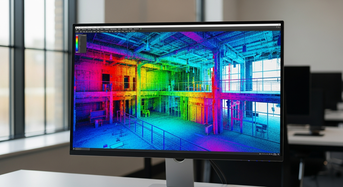
If you are comparing point cloud vs 3D model, the main difference is simple: a point cloud is raw captured site data, while a 3D model is organized, usable geometry built from that data or from field measurements. People often use the terms as if they mean the same thing, but they serve different purposes in real projects.
That distinction matters when you are planning a renovation, preparing permit documents, documenting an existing building, or deciding what to order from a drafting company. In California, owners, architects, contractors, and real estate professionals often need more than a scan alone. They need drawings and models that can actually support design decisions, coordination, and submittals. FastAsBuilt measures buildings on site and turns that information into permit-ready CAD files, so the question is not just what a point cloud is, but what deliverable will help you move the project forward.
Point cloud vs 3D model: the short answer
A point cloud is a large collection of measured points in 3D space. Those points represent surfaces that were captured in the field. If you scan a room, for example, the walls, windows, cabinets, ceilings, and floors may appear as dense clusters of points. The result can look like a ghosted digital copy of the space.
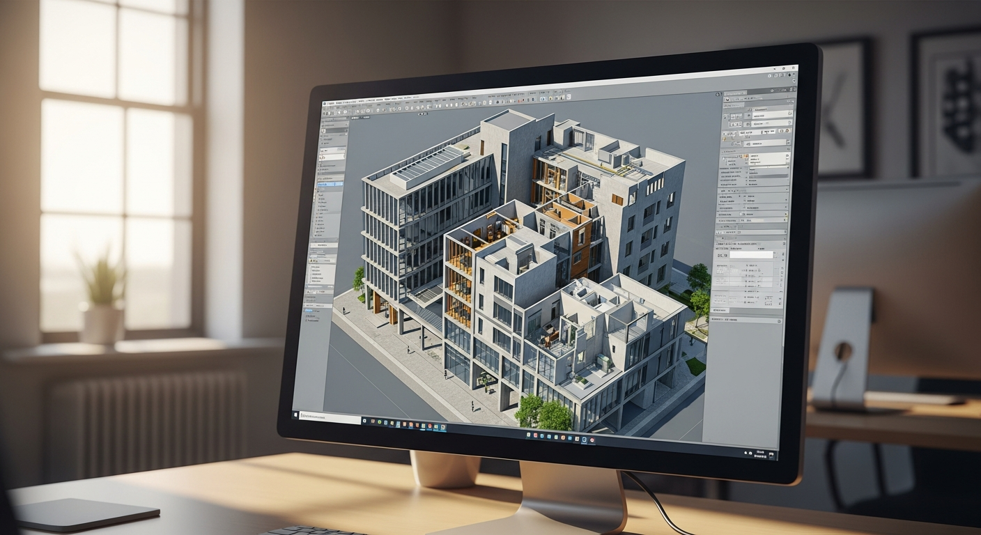
A 3D model is different. It converts existing conditions into recognizable building elements and geometry. Instead of millions of individual points, a model gives you objects and surfaces you can interpret and use more easily—such as walls, doors, stairs, roofs, elevations, and sections. A model may be created from point cloud data, but it can also be built from direct field measurements.
- Point cloud: raw 3D data capture
- 3D model: structured digital representation of the building
- Scan vs model: capture versus interpretation
- Practical difference: data alone versus a deliverable you can design from
If you are still deciding between 2D and 3D outputs, this overview of 2D vs. 3D as-built plans can help frame the choice.
What a point cloud actually is
In the point cloud vs model discussion, the point cloud is the starting layer of 3D data. Think of it as measured spatial evidence. Each point has a location in space, and together the points describe the surfaces of existing conditions.
Point clouds are useful because they preserve a lot of real-world detail. They can capture irregular areas, sloped ceilings, exposed structure, and conditions that would be slow to document by hand. That makes them valuable for complex existing buildings and projects where accuracy across many surfaces matters.
At the same time, a point cloud has limits. It is not the same as a set of clean plans. It does not automatically become a floor plan, elevation, or section. It also does not automatically turn into editable architectural geometry. To use it effectively, someone still needs to interpret the data and create the modeled or drafted output needed for the job.
Why raw scan data can be hard to use
- It can be visually dense and hard for non-specialists to read.
- It may include extra information that is not relevant to the deliverable.
- It does not by itself organize the building into standard drawing elements.
- It often needs software and experience to navigate properly.
That is why many clients asking for “a scan” are really asking for a usable set of as-builts or a model built from measured conditions.
What a 3D model actually is
A 3D model is a cleaned, structured representation of the building. Instead of a cloud of measured dots, you get geometry with intent. Walls read as walls. Openings read as openings. Floors, roofs, and stairs become understandable building components.
In practical terms, this is what makes a model useful for planning and communication. A designer can review spatial relationships more clearly. A contractor can understand how areas connect. An owner can visualize the building without trying to interpret raw 3D data. For many projects, that usability is the real value.
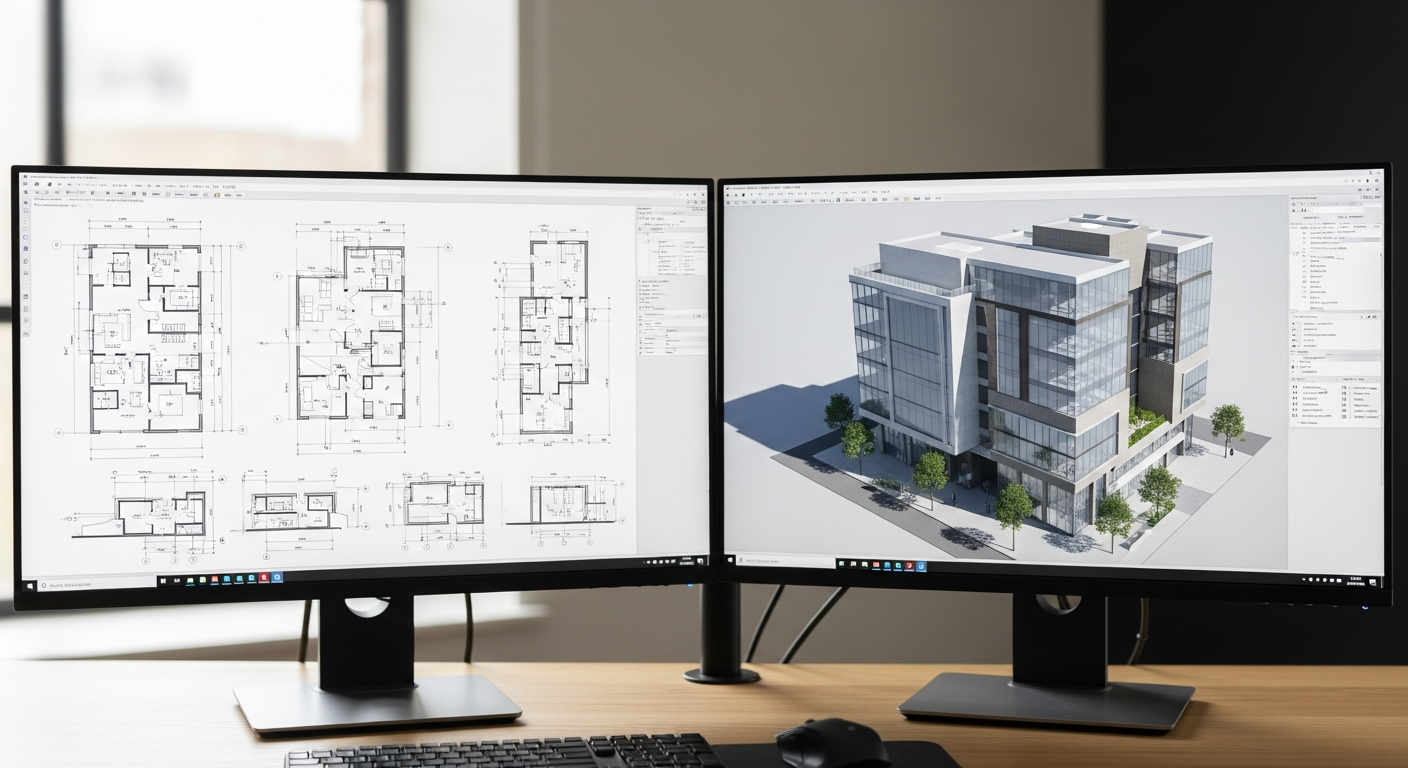
At FastAsBuilt, 3D As-Built Plans include a 3D model plus 2D floor plans, elevations, and sections. Typical delivery is 3–5 business days, with 2 revisions included. For simple documentation needs, 2D As-Built Plans may be enough. For projects that benefit from deeper coordination or a stronger understanding of existing conditions, a model can be the better fit.
Turnaround times are estimates and may vary based on project complexity and scheduling.
If you want a broader overview of what is typically included in a deliverable, see what’s included in as-built drawings.
Need accurate as-built plans?
FastAsBuilt sends a local crew to laser-measure your property and delivers permit-ready 2D or 3D drawings, starting at $900.
See 2D & 3D pricingScan vs model: why they are not interchangeable
People often say scan vs model as if they are competing products. In reality, they are different stages of work. A scan captures reality. A model interprets reality into a format people can use for design and documentation.
That distinction matters because project goals are rarely “collect as much data as possible.” The real goal is usually something more concrete:
- prepare for a remodel
- document an existing house
- support permit drawings
- plan an ADU or SB9 project
- coordinate a tenant improvement
- understand dimensions before design starts
For those goals, a raw point cloud may be only one step in the process. What most teams need is an output they can review, mark up, submit, or build from. That may be a 2D floor plan, a set of elevations and sections, or a full 3D model.
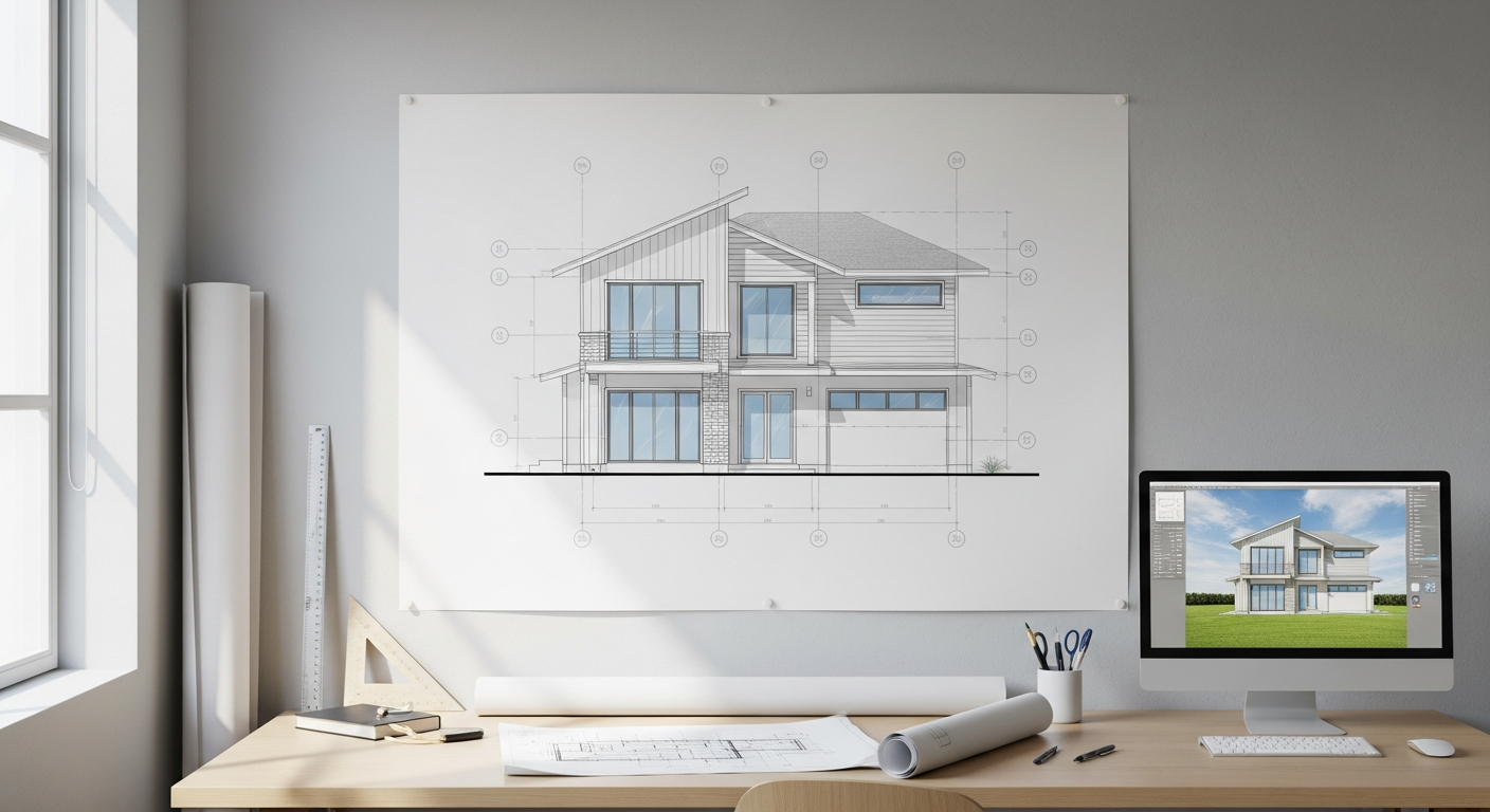
FastAsBuilt’s method reflects that reality: on-site laser measurement first, then senior drafters produce permit-ready CAD files in PDF and DWG. That is different from simply handing over unprocessed 3D data.
When a point cloud makes sense
There are cases where raw 3D data is especially helpful. If a building has unusual geometry, dense existing conditions, or surfaces that are difficult to measure conventionally, point cloud-style capture can be a strong foundation. It can also help when a project team wants a detailed digital reference of the existing structure before making changes.
Still, whether that raw data is enough depends on who will use it and what comes next. For many owners and smaller project teams, the need is not raw capture but interpretation.
A point cloud may make sense when:
- the building is large or geometrically complex
- you need a highly detailed record of existing conditions
- the next consultant in the chain specifically requests scan-based 3D data
- you expect a model or drawing set to be developed from that data afterward
Even then, the important question is not just whether to capture 3D data, but what final deliverable the architect, engineer, contractor, or permit reviewer will actually use.
When a 3D model makes more sense
For many renovation and planning projects, a model is more practical than raw scan data. It gives you a cleaner representation of the building and a format that is easier to review, coordinate, and share. If you need to understand how spaces fit together, compare options, or communicate existing conditions to multiple people, a model often has more day-to-day value.
This is especially true for residential projects in California, where owners may be working with architects, structural engineers, interior designers, and city permit requirements at the same time. A model and matching 2D plans create a clearer base for that work than a point cloud alone.
A 3D model is often the better choice when:
- you want a usable representation of an existing house or building
- your design team needs plans, elevations, and sections
- you want easier visualization than raw 3D data provides
- you need coordinated documentation for renovation planning
If your next step involves permits, this guide on as-built drawings for building permits explains why clean, organized documentation matters.
How this affects permits, design, and construction
The point cloud vs 3D model decision is not just technical. It affects how efficiently your project moves. Permit applications generally rely on understandable plans and supporting documentation, not just raw captured data. Designers need dependable base information they can work from. Contractors need clarity in dimensions, layout, and existing conditions.
That is why many projects start by asking for “3D data” but end up needing a more specific package of deliverables. For example:
- Permit preparation: usually needs organized plans and sometimes elevations or sections.
- Renovation design: often benefits from a model plus corresponding 2D documentation.
- Real estate due diligence: may only need measured floor plans.
- ADU or tenant improvement planning: typically needs accurate as-builts that design professionals can build on.
For file handling, it also helps to know what your team can open and edit. FastAsBuilt delivers permit-ready CAD files in PDF and DWG. If file type questions are part of your decision, review what file formats as-built drawings come in.
Choosing the right deliverable in California
In California, project needs vary widely from a single-family remodel in Los Angeles to an ADU in San Diego to a tenant improvement in the Bay Area. The best deliverable depends less on buzzwords and more on the actual use case.
Ask these questions before ordering:
- Do you need simple measured floor plans or a fuller 3D representation?
- Will an architect or engineer use the files for design development?
- Do you expect permit submittal work soon?
- Is the building straightforward or geometrically complex?
- Who needs to review the information, and in what format?
If your project only needs accurate existing floor plans, 2D As-Built Plans may be the most efficient option. They start at $900 for up to 1,500 square feet, then $0.50 per square foot, include 1 revision, and typically deliver in 48–72 hours.
Turnaround times are estimates and may vary based on project complexity and scheduling.
If you need a fuller digital representation, 3D As-Built Plans start at $1,500, then $1.00 per square foot. They include a 3D model plus 2D floor plans, elevations, and sections, with 2 revisions and typical delivery in 3–5 business days.
Turnaround times are estimates and may vary based on project complexity and scheduling.
Custom work such as commercial projects, ADUs, SB9 work, and tenant improvements is quoted individually. If you already know what you need, you can place an order online.
How FastAsBuilt approaches existing-condition documentation
FastAsBuilt focuses on field-measured as-built drawings and measured floor plans across California. Local crews serve Southern California, including Los Angeles, Orange County, and the Inland Empire, as well as the Bay Area and San Diego.
Our process is built around practical deliverables rather than vague data handoff. We measure on site using laser tools, then senior drafters turn those field measurements into permit-ready CAD files. That approach is designed for clients who need dependable existing-condition documentation they can actually use.
For some projects, that means 2D plans are the right answer. For others, a 3D package provides better value because it includes the model along with floor plans, elevations, and sections. The key is matching the output to the project rather than assuming all 3D data solves the same problem.
If you are evaluating broader scan-to-model workflows, this article on what scan to BIM is provides helpful context.
Frequently asked questions
Is a point cloud the same as a 3D model?
No. A point cloud is raw captured 3D data made up of many measured points. A 3D model is an organized digital representation of the building, typically created so people can review, design from, or coordinate around the existing conditions more easily.
Which is better: scan vs model?
Neither is automatically better in every case. A scan is better for capturing detailed existing conditions. A model is better for usability, communication, and design coordination. In many projects, the scan is the source data and the model is the useful output.
Do permits require a point cloud?
Usually, the more important requirement is clear, accurate documentation rather than raw scan data itself. Permit-related work commonly depends on organized plans and supporting drawings. If your goal is submittal readiness, a usable drafted or modeled deliverable is often more relevant than a point cloud alone.
How do you decide between 2D plans and a 3D model?
Start with how the information will be used. If you need accurate measured floor plans for a straightforward project, 2D may be enough. If you need stronger visualization, elevations and sections, or a more complete digital representation of the building, a 3D package is often the better fit.
Start with accurate as-builts
Order field-measured 2D or 3D as-built drawings and let a local crew handle the measuring and drafting.
Get instant pricingBottom line
In point cloud vs 3D model terms, the simplest way to think about it is this: a point cloud captures reality, while a 3D model organizes reality into something people can use. If your project needs practical existing-condition documentation for design, permitting, renovation, or planning, focus on the final deliverable—not just the capture method. FastAsBuilt helps California clients get measured, permit-ready drawings and 3D as-built packages matched to the job at hand.