
A floor flatness survey is used to measure how even a concrete slab or finished floor surface is across an area. In practice, people often use the term broadly to mean checking both flatness and levelness, even though those are not the same thing. Flatness looks at how much the surface changes over short distances. Levelness looks at how much the floor rises or falls relative to a reference plane or benchmark across a larger area.
If you are planning a tenant improvement, warehouse fit-out, equipment installation, remodel, or condition assessment, a reliable floor flatness survey can help you understand whether the existing floor is suitable for the work ahead. It can also help owners, architects, general contractors, and facility teams document existing conditions before changes begin. In California, that matters because a small floor issue can turn into a big coordination problem once cabinetry, glazing, racking, drains, accessibility features, or precision equipment are involved.
What a floor flatness survey actually measures
At a basic level, a floor flatness survey documents the shape of the floor surface. That may include local bumps, dips, ridges, slopes, birdbaths, edge curling, transitions between pours, and broader changes in elevation. The exact method depends on the project goal. Some surveys are intended to support a simple renovation layout. Others are meant to evaluate slab tolerances for construction quality, machinery alignment, or specialty flooring.
It helps to separate three related ideas:
- Flatness: how smooth the surface is over short distances.
- Levelness: how much the surface varies in elevation over longer runs.
- Slope or pitch: an intentional fall for drainage or a designed transition, which may be acceptable or required.
A good floor flatness survey does not just collect data. It frames the data around the decisions you need to make. For example, a warehouse owner may care about aisle conditions for rolling loads. A retail tenant may care about transitions under storefront systems. An architect may need accurate floor elevations to coordinate doors, partitions, and accessibility details. A flooring contractor may want a map of high and low areas to estimate prep work.
Why flatness and levelness are often confused
Many project teams ask for a “level floor” when the real issue is unevenness, lippage, or localized waviness. A floor can be generally level across a room but still have short, noticeable variations that affect finishes or equipment. The reverse can also be true: a floor may be consistently sloped in one direction but otherwise very smooth. That floor may feel “out of level” but still perform acceptably if the slope is intentional or within the relevant tolerance.
This distinction becomes important when writing scopes and reviewing proposals. If an RFP simply asks for a floor flatness survey without saying what decisions the survey must support, the result may be difficult to use. A useful scope usually identifies:
- The areas to be surveyed and any inaccessible zones
- The desired deliverables, such as CAD plans, spot elevations, heat maps, profiles, or a point cloud
- The intended use, such as design coordination, existing-condition documentation, or tolerance review
- The reference system, benchmark, or control points to be used
- Any required density of measurements or reporting intervals
That is where modern reality capture can help. Instead of relying only on sparse manual readings, project teams can use 3d laser scanning to capture dense surface information across large floor areas quickly. If you want a broad overview of the technology, reality capture in construction is the larger category, while how 3d laser scanning works for as-builts explains the practical field process.

When a floor flatness survey is worth ordering
Not every project needs a detailed digital survey, but many do. A floor flatness survey is especially useful when tolerances matter, when there is a dispute about existing conditions, or when rework would be expensive.
Common use cases include:
- Tenant improvements where partitions, millwork, storefronts, or accessible routes must align with the existing slab
- Industrial and warehouse projects involving racks, conveyors, forklifts, or other rolling systems
- Equipment installations for manufacturing, labs, healthcare, or commercial kitchens
- Flooring replacement where high and low spots affect prep scope and material selection
- Forensic or claims documentation when teams need an objective record of slab conditions before demolition or occupancy
- Renovation planning when accurate elevations reduce coordination problems across trades
In California, these surveys are often requested in existing commercial buildings where multiple generations of improvements have changed the floor over time. Slab conditions can also matter in adaptive reuse, older retail centers, and mixed-use spaces where drainage, accessibility, and finish transitions all intersect. A clear existing-condition survey does not replace design or engineering judgment, but it gives the team a reliable basis for those decisions.
How 3d laser scanning supports a floor flatness survey
Traditional slab checks often rely on straightedges, levels, total stations, or selected spot elevations. Those methods can work, but they sample the floor at limited intervals. By contrast, 3d laser scanning can capture a dense set of measurements across the floor surface and surrounding space. That makes it easier to see patterns that would be missed with sparse data collection.
For many projects, 3d laser scanning is not just about speed. It is about context. The same dataset used for the floor can also document walls, columns, storefronts, MEP elements, and overhead obstructions. That means the survey can support floor analysis and as-built documentation at the same time. If your team needs to understand the data structure behind a scan, this overview of what a point cloud is in as-built drawings is a good place to start.
Benefits of scanning-based floor surveys can include:
- Dense coverage over large areas
- Clear identification of broad slopes and localized deviations
- Better coordination with architectural and MEP conditions
- Digital records that can be revisited during design
- Faster field collection in occupied or time-sensitive spaces
That said, technology should match the question being asked. Some projects need a simple measured floor plan. Others need higher-density capture, analysis workflows, or registration to project control. If your team is weighing methods, terrestrial vs. mobile laser scanning can help clarify the tradeoffs.
Need accurate as-built plans?
FastAsBuilt sends a local crew to laser-measure your property and delivers permit-ready 2D or 3D drawings, starting at $900.
See 2D & 3D pricingReality capture methods and what they are good at
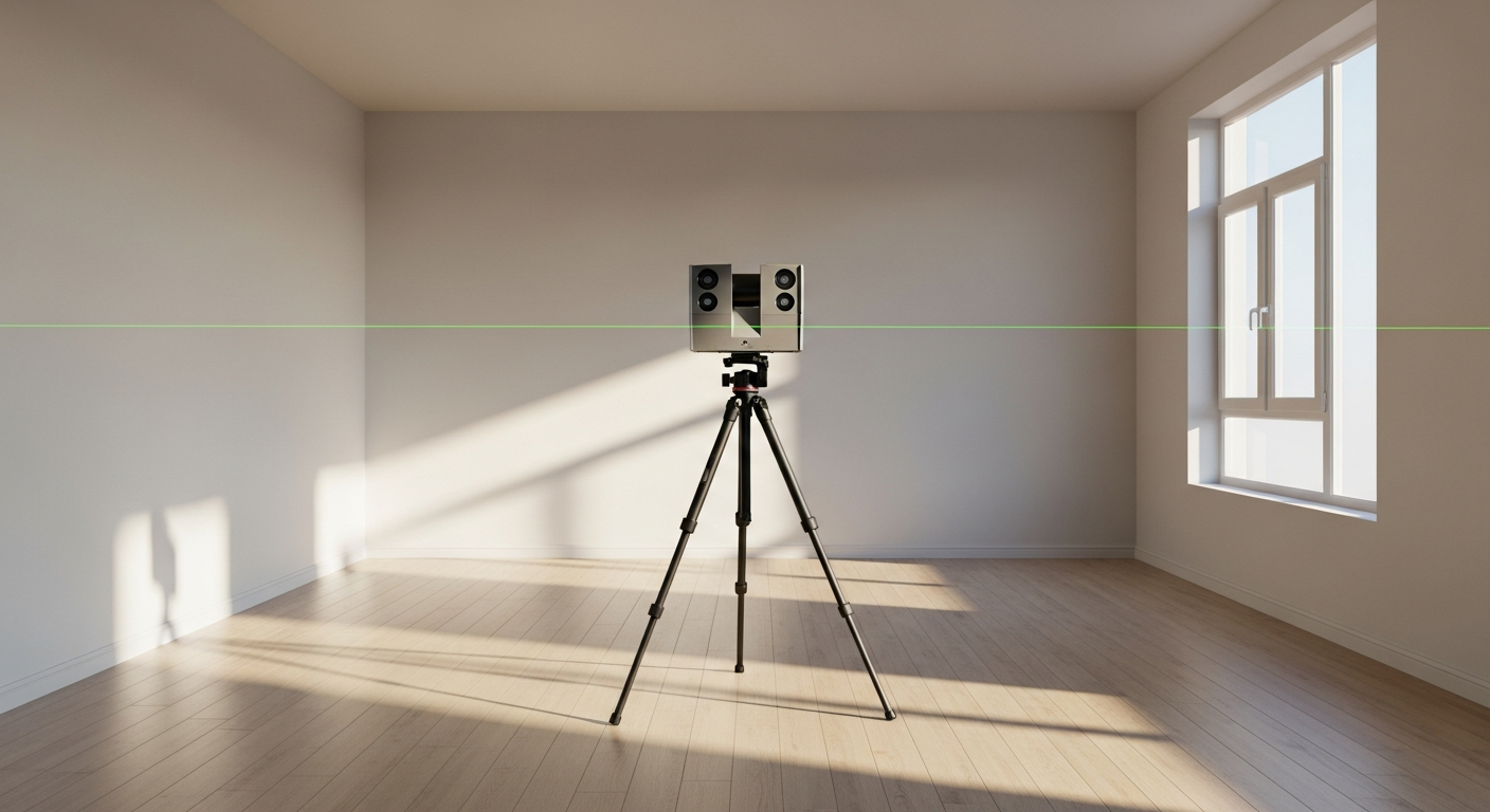
Reality capture is a broad term that includes several ways to document existing conditions digitally. For floor flatness work, the most common methods are terrestrial laser scanning, mobile scanning, total station survey support, and in some cases supplemental photogrammetry. Each has strengths and limitations.
Terrestrial laser scanning
This method uses a stationary scanner set up at multiple locations. It generally provides strong geometric reliability and detailed coverage, especially indoors. It is well suited to flatness and levelness documentation where a stable, repeatable dataset matters.
Mobile scanning
Mobile systems can move through the space more quickly, which can help on large interiors. Depending on the system and site conditions, they may be useful for general existing-condition capture, but project teams should confirm whether the method is appropriate for the level of slab analysis they need.
Total station or control-supported survey
When a project requires strict benchmarking to site control or ties to a larger survey framework, targeted survey control may be used alongside scanning. This can help align floor data to project coordinates or reference elevations.
Photogrammetry
Photogrammetry uses overlapping photographs to reconstruct geometry. It can be useful in some contexts, but for interior floor tolerance analysis, laser scanning is often preferred because it is less dependent on surface texture and lighting. For a practical comparison, see laser scanning vs. photogrammetry.
The key point is that a floor flatness survey is not one-size-fits-all. The best method depends on the floor area, access conditions, reporting requirements, and how the information will be used by the design or construction team.
What deliverables to ask for in an RFP or scope
Technical searchers and procurement teams often need more than a general description. If you are writing an RFP for a floor flatness survey, be specific about the deliverables. A vague request for “scan the floor and provide results” often leads to mismatched expectations.
Depending on the project, useful deliverables may include:
- 2D CAD floor plans with spot elevations
- Colorized elevation maps or deviation heat maps
- Floor surface contours or graded bands
- Section cuts and longitudinal or transverse profiles
- Raw or processed point cloud files
- Registered scan data tied to benchmarks or control
- PDF exhibits for coordination meetings and permit or plan-review support where appropriate
- DWG files for design team use
At FastAsBuilt, our core workflow is on-site laser measurement followed by senior drafters producing permit-ready CAD files in PDF and DWG. For projects centered on existing conditions, our 2D As-Built Plans start at $900 for up to 1,500 square feet, then $0.50 per square foot, include one revision, and are typically delivered in 48–72 hours. Our 3D As-Built Plans start at $1,500, then $1.00 per square foot, and include a 3D model plus 2D floor plans, elevations, and sections, with two revisions and typical delivery in 3–5 business days. Commercial spaces, tenant improvements, ADUs, and other custom scopes are quoted individually. If you already know your project needs, you can review options on our packages page.
Turnaround times are estimates and may vary based on project complexity and scheduling.
For a floor flatness survey, it is also smart to state whether you need interpreted exhibits or simply the measured geometry. Many teams need both: a clean CAD base for design and a visual report that highlights where the slab may need attention.
Accuracy, tolerances, and the limits of the survey
One of the most common questions is whether scanning is accurate enough for technical work. The short answer is that 3d laser scanning can be highly useful for documenting existing conditions, but the right answer depends on the tolerance that matters to your project and the field method used to achieve it.
Accuracy should be discussed in practical terms, not marketing terms. Ask:
- What tolerance are you trying to verify?
- Over what distance or grid interval?
- Is the goal design coordination, construction verification, or dispute documentation?
- Will the data be tied to site control or used as relative measurements only?
For permit and renovation planning, many teams use scanning-based as-builts successfully. For a broader discussion, see is 3d scanning accurate enough for permits and how accurate 3d laser scanning is for as-builts. Those articles help explain why the real issue is not a single universal accuracy number, but whether the workflow, control, and deliverables fit the decisions being made.
It is also important to understand what a survey does not do by itself. A floor flatness survey documents existing conditions. It does not automatically establish code compliance, structural adequacy, or acceptable finish performance. Those conclusions belong to the appropriate design professional, engineer, contractor, manufacturer, or authority having jurisdiction based on the project context.
California project considerations
California projects add a few practical layers to floor survey planning. Existing buildings are often occupied, access windows may be tight, and permitting paths vary by city. In older buildings, previous alterations may have introduced inconsistent finished-floor heights, ramps, patched trenches, or hidden transitions that are not obvious from legacy drawings.
Accessibility coordination is one common reason teams order a floor flatness survey. Existing slopes, thresholds, and elevation changes can affect route planning and finish selections. Energy and envelope work can also trigger coordination challenges at storefronts and perimeter conditions. In some cases, Title 24-related upgrades or local plan-check comments create a need for more reliable as-built information, even though the floor survey itself is not a Title 24 compliance report. Requirements vary by jurisdiction, so it is always wise to confirm specific submittal expectations with the local building department and the design team.
For tenant improvements and commercial remodels, the practical value is simple: good field data reduces surprises. A well-documented floor surface can help avoid rushed field fixes after framing, glazing, casework, or equipment arrives. That is especially important when schedules are tight and trades are sequenced closely.

What the field process usually looks like
Most floor flatness survey projects begin with a conversation about scope, access, and deliverables. The field team then visits the site and captures the space using on-site laser measurement. Depending on the project, that may focus on the floor surface alone or include surrounding walls, openings, columns, and overhead systems that affect design coordination.
A typical workflow includes:
- Reviewing the requested area, access limits, and any known problem zones
- Establishing reference points or working from agreed benchmarks
- Capturing the floor and surrounding conditions with laser measurement
- Registering and organizing the field data
- Drafting floor plans, elevations, sections, or custom exhibits as required
- Quality review before delivery in PDF and DWG formats
FastAsBuilt serves projects across California with local crews in Southern California, the Bay Area, and San Diego. That local coverage helps when projects need quick site visits, phased documentation, or follow-up measurement in active commercial spaces.
Occupancy matters too. In active stores, offices, healthcare spaces, or industrial buildings, field teams may need to work around operations, after-hours access, or temporary obstructions. If you are wondering whether your staff must be present throughout capture, this article on whether you need to be onsite for a 3d scan covers the practical considerations.
How to decide between 2D and 3D deliverables
For many owners and contractors, the simplest useful output is a 2D drawing set showing the measured floor layout with key dimensions and elevations. That works well when the project mainly needs a dependable base plan for design, estimating, and permit support. If the issue is localized floor variation within a straightforward remodel, 2D deliverables may be enough.
3D deliverables become more valuable when floor conditions interact with other building elements. If your team needs to coordinate slab elevations with storefront systems, overhead MEP, equipment pads, ramps, structural features, or complex interiors, a 3D model and related sections can save time and reduce interpretation errors. This is often the better choice for larger commercial spaces, existing-condition modeling, and multidisciplinary coordination.
At FastAsBuilt, 2D As-Built Plans and 3D As-Built Plans follow the same core principle: careful field measurement first, then senior drafting. The difference is the depth of modeling and the set of outputs. Choosing the right package is less about technology for its own sake and more about what your project team needs to make decisions confidently.
Start with accurate as-builts
Order field-measured 2D or 3D as-built drawings and let a local crew handle the measuring and drafting.
Get instant pricingFrequently asked questions
Is a floor flatness survey the same as checking whether a floor is level?
No. A floor flatness survey often includes both ideas, but flatness and levelness are different. Flatness is about short-range smoothness. Levelness is about elevation change over longer distances relative to a reference. A floor can be smooth but intentionally sloped, or generally level but locally uneven.
Can 3d laser scanning be used for a floor flatness survey?
Yes, in many cases it can. 3d laser scanning is often useful because it captures dense surface data and provides context for surrounding building elements. The important question is whether the scanning workflow, control, and reporting method fit the tolerance and decision-making needs of the project.
What should be included in the final deliverable?
That depends on the use case. Common deliverables include 2D CAD plans with spot elevations, PDFs, DWG files, floor elevation maps, sections, and sometimes point cloud data. If the survey is being ordered for design coordination, ask for outputs your architect, engineer, or contractor can work with directly.
How long does a survey and drawing package usually take?
For standard as-built work, FastAsBuilt typically delivers 2D As-Built Plans in 48–72 hours and 3D As-Built Plans in 3–5 business days, depending on scope. A floor flatness survey with custom reporting, large commercial areas, or special coordination requirements may require a custom quote and schedule.
Turnaround times are estimates and may vary based on project complexity and scheduling.
Will a floor flatness survey be enough for permit approval?
A survey can provide accurate existing-condition documentation that supports permit drawings, but it is not a permit approval by itself. Local building departments and project professionals determine what else is required. In California, always confirm submittal expectations with the local jurisdiction and your design team.
Bottom line
A floor flatness survey gives your team a measured picture of the slab you actually have, not the one shown on old drawings or assumed in the field. When paired with 3d laser scanning and thoughtful reality capture, it can support better planning, fewer surprises, and clearer coordination across California renovation and construction projects. If you need permit-ready CAD drawings, measured floor plans, or a custom existing-conditions scope, FastAsBuilt can help document the site and turn field data into usable PDF and DWG deliverables.