
A construction verification scan is a field capture of existing site conditions used to confirm what is actually in place. In practice, that usually means using 3D laser scanning and related reality capture methods to document geometry, dimensions, elevations, openings, structural elements, and visible building systems before design, coordination, retrofit, or closeout work continues.
For owners, architects, engineers, contractors, and facilities teams in California, the value is simple: better decisions based on current field conditions instead of assumptions. A construction verification scan can reduce redesign, expose conflicts early, support renovation planning, and create a reliable base for as-built drawings. FastAsBuilt provides field-measured as-built drawings and measured floor plans across California, with local crews in Southern California, the Bay Area, and San Diego using on-site laser measurement and senior drafters to produce permit-ready CAD files in PDF and DWG formats.
What a construction verification scan actually means
The term “construction verification scan” is often used broadly, so it helps to define it clearly. At its core, the scan is not the final drawing package by itself. It is the documentation step that captures what exists at a point in time so the project team can verify dimensions, layout, and visible conditions against design documents, prior plans, shop drawings, or installation requirements.
Depending on project goals, a verification scan may support:
- Pre-design documentation for remodels, additions, tenant improvements, ADUs, and SB 9 projects
- Verification of framing, slab, wall, ceiling, window, or door locations before downstream trades proceed
- Existing-condition capture for permit submittals and consultant coordination
- Post-installation confirmation for MEP routing, equipment placement, or façade elements
- Facilities records for long-term operations, maintenance, and future renovations
In other words, the scan is part of a workflow. If you are comparing methods, it can help to review how 3D laser scanning works for as-builts and where the scan fits between field capture and final CAD production.

How verification scanning differs from a basic site measure
Not every project needs the same level of capture. A simple field measure may be enough for a small, straightforward space where the main need is overall room dimensions and opening sizes. A construction verification scan is usually selected when the space is complex, the tolerances matter, the schedule is tight, or several parties need to work from the same verified existing-condition record.
Compared with manual tape or handheld measuring alone, 3D laser scanning and broader reality capture can document more of the built environment in less time on site, especially when there are uneven walls, irregular structural conditions, soffits, sloped elements, crowded utility zones, or hard-to-access spaces. It also gives the team a way to revisit the captured conditions digitally after the site visit rather than relying only on field notes.
This distinction matters in renovation-heavy California markets. Existing buildings in Los Angeles, Orange County, San Diego, and the Bay Area often have layered alterations from different decades. Original plans may be incomplete, prior work may not match drawings, and hidden assumptions can become expensive quickly. A verification scan helps establish a cleaner starting point.
If you are deciding between capture methods, see laser scanning vs. tape measuring for as-builts for a practical comparison.
What gets captured during a construction verification scan
The exact scope depends on what you need to verify. Some clients want only the architectural shell. Others need enough detail to support structural review, equipment coordination, or a full digital model. A good scope starts by identifying the decisions the scan must support.
Common capture targets include:
- Exterior footprint, wall faces, corners, and roof edges that can be measured safely from accessible positions
- Interior room sizes, wall locations, ceiling heights, soffits, columns, beams, and stairs
- Door and window openings, sill and head heights, swing direction, and frame locations
- Visible MEP components such as ducts, piping runs, conduit, panels, diffusers, and equipment clearances
- Floor level changes, slab depressions, ramps, and other elevation-sensitive conditions
- Façade geometry, storefronts, exposed structure, and other irregular or hard-to-measure conditions
Not every verification scan captures every visible object with the same level of detail. The deliverable should match the use case. If the goal is permit-ready 2D plans, the field capture should be sufficient for that drafting scope. If the goal is a model for coordination or fabrication planning, the team may need denser and more complete capture.
Many technical users also ask about the raw scan output. In most 3D laser scanning workflows, the field data becomes a point cloud. If that term is part of your RFP language, this overview of what a point cloud is in as-built drawings explains the concept in practical terms.
Where reality capture fits into the process
Reality capture is the umbrella term for technologies used to digitally document existing conditions. A construction verification scan is one application of reality capture. Depending on the site, that can include terrestrial laser scanning, mobile scanning, LiDAR-based capture, photography, or drone work for limited exterior conditions. The right mix depends on access, geometry, deliverables, and acceptable tolerance.
For most building interiors and many renovation projects, terrestrial 3D laser scanning remains the most dependable verification method because it captures dense spatial data from fixed positions throughout the site. That makes it well suited for validating dimensions and building a trustworthy base for as-built drawings.
Reality capture also helps different stakeholders use the same source conditions in different ways:
- Architects can develop existing-condition plans, elevations, and sections
- Engineers can review clearances and visible system routing
- Contractors can identify conflicts before procurement or installation
- Owners can keep a current facility record for future work
For a broader explanation of the term, see what reality capture in construction means.
Need accurate as-built plans?
FastAsBuilt sends a local crew to laser-measure your property and delivers permit-ready 2D or 3D drawings, starting at $900.
See 2D & 3D pricing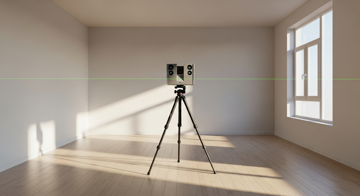
Typical deliverables from a verification scan
The scan itself is only useful when it becomes a deliverable your team can use. That may be a point cloud, drafted plans, a modeled representation, or a combination. FastAsBuilt’s workflow combines on-site laser measurement with senior drafters who turn field data into permit-ready CAD files.
Common deliverables include:
- 2D as-built floor plans in PDF and DWG
- Elevations and building sections where needed
- 3D models for projects that require more spatial coordination
- Area calculations and room-by-room layout documentation
- Existing-condition files used by architects, engineers, and contractors
FastAsBuilt offers 2D As-Built Plans starting at $900 for up to 1,500 square feet, then $0.50 per square foot, with 1 revision and typical 48–72 hour delivery. For more complex needs, 3D As-Built Plans start at $1,500, then $1.00 per square foot, and include a 3D model plus 2D floor plans, elevations, and sections, with 2 revisions and typical 3–5 business day delivery. Commercial properties, ADUs, SB 9 work, and tenant improvements are quoted individually because scope can vary substantially.
Turnaround times are estimates and may vary based on project complexity and scheduling.
If your next step is pricing and scope, you can review as-built drawing costs in California or go directly to order a project.
When a construction verification scan is worth it
A verification scan is most valuable when uncertainty is expensive. That usually means one of three things: field conditions are irregular, multiple disciplines need coordinated existing-condition information, or rework would cost more than the scan.
High-value use cases
- Renovations in older California buildings where records are incomplete or outdated
- Tenant improvements with dense ceilings, tight clearances, or complex MEP coordination
- ADU and small-lot infill work where setbacks, footprint limits, and existing structures matter
- Commercial projects where several consultants need one trusted base file
- Historic or character properties where preserving existing geometry is important before alterations
- Verification before prefabricated or custom-fabricated elements are finalized
It can also be useful for code-related planning. In California, projects touching energy compliance, accessibility, multifamily alterations, exterior elevated elements, or local preservation review may require accurate existing-condition documentation. Rules tied to Title 24, SB 721, SB 326, Mills Act properties, or local review procedures vary by building type and jurisdiction, so project teams should confirm current requirements with the local city or county before relying on a generic checklist.
The key point is not that a scan replaces design review or code analysis. It gives your design and construction team a more reliable factual base for those tasks.

Accuracy, limitations, and what to clarify before you hire
One of the biggest misunderstandings about a construction verification scan is assuming every scan produces the same level of precision and usefulness. In reality, quality depends on equipment, field coverage, operator skill, site access, obstructions, and how the final drawings or model are produced.
That is why scope definition matters. Before hiring a provider, clarify:
- What spaces are included and excluded
- Whether roofs, exteriors, crawlspaces, mezzanines, or utility rooms are part of the work
- Whether you need only plans or also elevations, sections, and a 3D model
- How visible MEP items will be documented
- What file formats will be delivered
- How revisions are handled
- Whether the files are intended for permit use, design reference, or coordination only
It is also important to understand limitations. A scan captures what is visible from accessible vantage points. It does not automatically reveal concealed framing, in-wall utilities, or above-ceiling conditions blocked from view. It may also require supplemental field verification where reflective surfaces, clutter, restricted access, or active construction create gaps.
For a more focused discussion, see how accurate 3D laser scanning is for as-builts. The practical takeaway is that scan accuracy is only part of the story; usable deliverables depend just as much on complete field coverage and careful drafting.
How FastAsBuilt handles verification work in California
FastAsBuilt is built around a straightforward process: local crews perform on-site laser measurement, then senior drafters convert that field information into clean, permit-ready CAD files. That approach is designed for teams that need existing-condition documentation they can actually use, not just raw field data.
Because FastAsBuilt serves Southern California, the Bay Area, and San Diego with local crews, projects can be scheduled with regional familiarity in mind. That matters in California, where building stock ranges from small postwar homes to mixed-use commercial spaces, hillside properties, multifamily renovations, and heavily altered tenant spaces.
For clients, the process typically looks like this:
- Define the property type, square footage, and deliverable needs
- Schedule an on-site visit for laser measurement
- Capture existing conditions in the field
- Draft permit-ready files in PDF and DWG
- Review and revise within the included revision allowance
This workflow is especially useful when a project needs practical output quickly. FastAsBuilt’s typical delivery is 48–72 hours for 2D As-Built Plans and 3–5 business days for 3D As-Built Plans, depending on scope. For custom commercial and code-sensitive projects, quoting is individualized so the deliverables align with actual project needs rather than a generic package.
Turnaround times are estimates and may vary based on project complexity and scheduling.
How to write a better RFP for a construction verification scan
Many technical searchers looking for “construction verification scan” are not just researching the concept. They are preparing a scope request. A better RFP gets better proposals and fewer change orders. The main goal is to define the intended use of the scan, not just the technology.
Include these items in your scope
- Property address, type, and approximate square footage
- Project purpose: renovation, permit drawings, coordination, closeout, facilities record, or dispute resolution
- Areas to capture and any exclusions
- Required deliverables: floor plans, elevations, sections, model, DWG, PDF, point cloud, or combinations
- Expected level of visible detail for architectural, structural, and MEP items
- Access constraints, occupancy conditions, and allowed field hours
- Schedule requirements and review milestones
- Whether permit-ready drafting is required
It also helps to describe what decisions the files must support. For example, “verify storefront dimensions for replacement,” “document unit layouts for multifamily renovation,” or “capture visible overhead utilities for tenant improvement coordination” is much more useful than simply saying “scan building.”
If you are comparing scanning methods in your RFP, method choice should track the building and use case. A fixed-position scanner may be best for precision interior verification, while other tools may supplement exteriors or fast walkthrough conditions. The point is to request the outcome you need rather than naming technology without context.
Frequently asked questions
Is a construction verification scan the same thing as an as-built drawing?
No. The construction verification scan is the field capture step used to document existing conditions. As-built drawings are drafted deliverables created from field measurement, scan data, and review. On many projects, the scan supports the as-built package, but the scan itself is not the final drawing set.
When should you choose 3D laser scanning instead of manual measuring?
3D laser scanning is often the better choice when the building is complex, irregular, or coordination-heavy; when several consultants need the same reliable base; or when the cost of field misses is high. Manual measuring can still be appropriate for smaller, simple spaces with limited detail requirements.
Can a verification scan be used for permit drawings in California?
It can support permit drawings by providing accurate existing-condition information, but permit acceptance depends on the actual drawing set and the local jurisdiction’s requirements. Cities and counties may have different expectations for scope, notation, and consultant responsibility, so confirm with the local authority having jurisdiction before submittal.
Does a scan capture hidden conditions behind walls or above ceilings?
No, not by default. A construction verification scan records visible, accessible conditions from the scan positions used on site. Concealed framing, hidden utilities, and blocked spaces may require destructive verification, additional access, or separate investigation by the appropriate trade or consultant.
What should you ask for if you need both current dimensions and a usable CAD file?
Ask for a defined existing-condition deliverable, such as permit-ready 2D as-built plans in PDF and DWG, and specify whether you also need elevations, sections, or a 3D model. If the project depends on verified geometry rather than raw data alone, make sure drafting and revision terms are part of the scope.
Start with accurate as-builts
Order field-measured 2D or 3D as-built drawings and let a local crew handle the measuring and drafting.
Get instant pricingBottom line
A construction verification scan gives your team a dependable record of what is actually built so design, permit, coordination, and renovation decisions start from reality instead of guesswork. For California projects, that can mean fewer surprises, cleaner consultant coordination, and faster progress toward usable as-built files. FastAsBuilt combines on-site laser measurement with senior drafting to deliver permit-ready CAD outputs across Southern California, the Bay Area, and San Diego, whether you need a straightforward measured floor plan or a more detailed 3D as-built package.