
If you are asking what is a topographic survey, the short answer is simple: it is a measured map of a property’s ground surface and visible site features. It shows elevation changes, slopes, contours, drainage patterns, and physical items such as driveways, walls, fences, utility structures, trees, and buildings. Architects, engineers, contractors, and property owners use it to understand how a site actually sits before design or construction begins.
In California, that matters more than many owners expect. A flat-looking lot can still have subtle grade changes that affect drainage, access, retaining walls, foundation design, or where an addition can realistically go. A topographic survey gives the project team a reliable base to work from. It is different from an interior measured plan, but the two often support the same project when you are remodeling, building an ADU, planning site work, or preparing permit documents.
What is a topographic survey?
A topographic survey is a site survey that records the horizontal location and vertical elevation of existing conditions on a parcel of land. The goal is to create a clear picture of the site’s shape and features, not just its property lines. The finished survey typically includes contour lines or spot elevations that show how the land rises and falls across the property.
When people search for what is a topographic survey, they are usually trying to answer one of three practical questions:
- What does my land look like in measurable terms?
- What existing features could affect design, construction, or drainage?
- What drawing do my architect or engineer need before they start?
A topographic survey is often part of the early due diligence stage for residential and commercial projects. It helps the design team see the site as it exists today rather than relying on assumptions, satellite images, or old plans that may no longer be accurate.

What a topographic survey typically shows
While scope varies by project and surveyor, a topographic survey commonly includes both natural and man-made features that can affect design and construction. The exact deliverables should always be confirmed with the licensed survey professional and the local jurisdiction if the survey will support permit drawings.
Ground and elevation information
- Contour lines showing elevation changes across the site
- Spot elevations at key points
- High points, low points, swales, berms, and slopes
- Finished grades around buildings, walks, and paved areas
Visible site features
- Building footprints
- Driveways, walkways, patios, and parking areas
- Retaining walls, fences, gates, and stairs
- Trees, planters, and sometimes notable landscaping elements
- Utility structures such as meters, manholes, valves, poles, or inlets
Location context
- Property boundaries if included in the survey scope
- Adjacent street elevations, curb lines, and sidewalks
- Other features that may affect site access or drainage
Some clients assume a topographic survey automatically includes every legal boundary question, utility location, or interior building measurement. It does not. Scope matters. A topo survey is focused on mapping the site’s physical conditions. If your project also needs interior documentation, a measured as-built floor plan may be the companion document that fills in the building side of the picture.
Why topographic surveys matter for design and permitting
A design team can only be as accurate as the information it starts with. If the existing grade is wrong, almost every downstream decision can be affected. That includes drainage direction, stair counts, foundation steps, finish floor assumptions, accessible paths, wall heights, driveway transitions, and grading quantities.
For California projects, topographic information is especially important when a site has any of the following:
- Noticeable slope or terraced yard areas
- Retaining walls or grade separations
- Drainage concerns near structures
- Street-to-garage elevation changes
- ADU or addition plans in a tight backyard
- Hillside or coastal review considerations
Many cities and counties want site plans that reflect actual existing conditions. Even when a full topo survey is not explicitly required, accurate grade information can prevent redesign and questions during plan review. If your work also involves documenting an existing structure, it helps to understand what is included in as-built drawings so you can see where site and building information overlap and where they do not.
For owners, the value is straightforward: fewer surprises. A topographic survey can reveal that a pad is not level, that drainage moves toward the house, or that a proposed outdoor improvement will need more grading than expected. That clarity often saves time later.
Need accurate as-built plans?
FastAsBuilt sends a local crew to laser-measure your property and delivers permit-ready 2D or 3D drawings, starting at $900.
See 2D & 3D pricingTopographic survey example
A practical topographic survey example is a homeowner planning a detached ADU behind an existing house in Los Angeles. The lot appears mostly flat from the street, but the backyard actually drops several feet from rear patio to alley. There is also a retaining wall, a detached garage slab, and a side yard path that narrows toward the back.
In that case, the topographic survey may show:
- Contour lines across the backyard
- Spot elevations at the patio, garage slab, side yard, and alley edge
- The height and location of the retaining wall
- Existing drainage inlets or visible runoff paths
- The relationship between the house finish floor and the proposed ADU area
That one survey can influence several major decisions. The designer may raise or lower the proposed ADU finish floor, adjust the path of travel, change drainage design, revise stairs, or relocate the building slightly to reduce site work. Without topo data, the concept might look fine on paper and fail once real dimensions are applied.
The same logic applies to commercial properties. A tenant improvement may mainly concern the interior, but exterior accessibility routes, pad transitions, or service areas can still make topo information necessary. Where a project combines exterior and interior documentation, teams often pair site survey work with existing conditions plans or measured as-built documentation.
Topographic survey vs floor plan
One of the most common points of confusion is topographic survey vs floor plan. They are not the same document, and they answer different questions.
What a topographic survey answers
- How does the land slope?
- What are the site elevations?
- Where are exterior features located on the property?
- How might drainage, access, or grading affect the project?
What a floor plan answers
- How are interior rooms arranged?
- Where are walls, doors, and windows?
- What are the room dimensions?
- How does the building layout function?
A floor plan is a horizontal cut through a building, focused on interior space. A topographic survey is a map of the land surface and site features. If you are remodeling a kitchen, a floor plan may be enough. If you are adding square footage, changing site drainage, building an ADU, or working on a sloped property, you may need both.
FastAsBuilt focuses on field-measured as-built drawings and measured floor plans across California. Our crews perform on-site laser measurement, and our senior drafters produce permit-ready CAD files in PDF and DWG format. For many renovation and addition projects, owners come to us for the building documentation while a licensed survey professional provides topo or boundary work as needed. If you want to understand the building side more clearly, see what an as-built survey means in practice.
Topographic survey vs plot plan
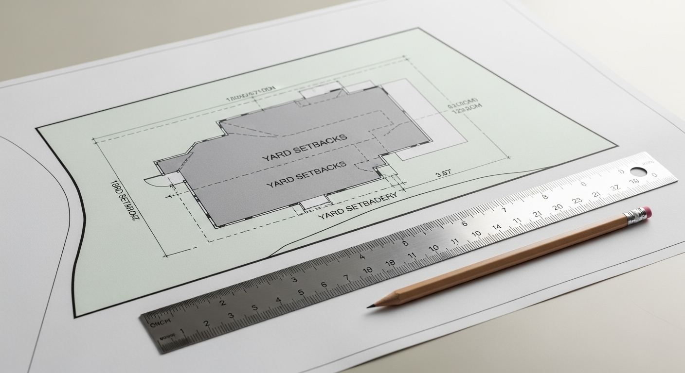
Another useful comparison is topographic survey vs plot plan. A plot plan generally shows the arrangement of structures and major improvements on a parcel relative to property lines, setbacks, easements, and other site constraints. Depending on the source and purpose, it may be simpler and less elevation-focused than a topo survey.
A topographic survey adds the vertical dimension. It tells you not just where something is, but also how high or low it is compared to surrounding areas. For projects involving grading, drainage, retaining walls, or hillside design, that elevation data is often the critical difference.
If you are sorting out the right base document for a permit set, it can help to compare topo work with what a plot plan is used for. In many California projects, the design team uses both: a survey-based site document to establish location and elevation, and measured building plans to document the structure itself.
Who prepares a topographic survey?
A topographic survey is typically prepared by a licensed land surveyor or another qualified survey professional working within California requirements. Because topo surveys can support legal descriptions, site design, engineering, and permitting, they should come from the right licensed source for the scope involved.
That is an important distinction from measured as-built floor plans. FastAsBuilt documents existing building conditions through on-site laser measurement and drafting, then delivers permit-ready CAD files. Our 2D As-Built Plans start at $900 for up to 1,500 square feet, then $0.50 per square foot, include one revision, and typically deliver in 48 to 72 hours. Our 3D As-Built Plans start at $1,500, then $1.00 per square foot, include a 3D model plus 2D floor plans, elevations, and sections, include two revisions, and typically deliver in 3 to 5 business days. Custom commercial, ADU, SB9, and tenant improvement projects are quoted individually.
Turnaround times are estimates and may vary based on project complexity and scheduling.
In other words, topo survey work and as-built documentation are complementary services, not interchangeable ones. If your architect asks for both, it usually means the project needs accurate information about both the land and the building.

When California property owners usually need one
Not every project needs a topographic survey, but many do. In California, topo surveys commonly come up when you are planning work that depends on accurate site elevations or exterior existing conditions.
- New construction on a vacant or partially improved lot
- Room additions that affect setbacks, drainage, or grade transitions
- Detached or attached ADUs
- SB 9 lot split or multi-unit planning where site constraints matter
- Driveway, retaining wall, or hardscape redesign
- Pools, decks, or outdoor structures on sloped sites
- Commercial development and tenant improvement projects with exterior path-of-travel work
California rules can also indirectly increase the importance of accurate existing documentation. For example, Title 24 compliance, accessibility planning, drainage review, and local grading requirements may all rely on sound base information. If your project touches ADU rules, SB 9, or local hillside standards, confirm requirements with the city or county reviewing your permit. State laws set broad frameworks, but local interpretation and submittal expectations still matter.
For owners comparing drawing types, it is also useful to understand as-built plans versus construction drawings. A topo survey records what exists on the site. Construction drawings show what is proposed to be built. As-built plans record the current building layout. Most real projects use more than one of these documents.
What the process usually looks like
Although survey firms have their own methods, the basic workflow is usually straightforward. First, the survey scope is defined. That includes the property area, the needed level of detail, whether boundary information is included, and what the architect or engineer expects to receive.
Next comes fieldwork. The survey team visits the site and captures measured data points across the property. They record elevations and locations for visible features called for in the scope. After field collection, the survey data is processed and drafted into a drawing that the design team can use.
For owners, the most important step is often the first one: define the scope clearly. Ask what the survey will show, whether contours are included, whether boundary information is part of the package, and what file formats will be delivered. If your project also needs interior plans, you can order those separately through FastAsBuilt’s ordering page so your consultants have a fuller base set to work from.
It is also wise to ask your architect, designer, or permit expediter exactly what the jurisdiction expects. Some cities may be satisfied with limited site information for minor work, while others will expect more complete topo data for additions, new structures, or grading-related permits.
How topographic surveys work with as-built drawings
Topographic surveys and as-built drawings are often used together because they describe different parts of the same property. The topo survey documents the site. As-built drawings document the building. When combined, they give the design team a clearer existing-conditions record.
That combination is especially helpful for:
- ADU planning where both backyard grades and existing house layout matter
- Additions that connect interior floor levels to exterior access routes
- Tenant improvements with exterior accessibility upgrades
- Historic or complex remodels where old plans are unreliable
- Properties with retaining walls, steps, or split-level conditions
If your team is trying to reconstruct accurate documentation from incomplete records, review what as-built drawings are and how they are used. In many cases, the fastest path is to gather fresh field data instead of guessing from outdated files. That is exactly why property owners across Los Angeles, Orange County, the Inland Empire, the Bay Area, and San Diego use FastAsBuilt for measured plans.
Common misconceptions
Several misunderstandings come up again and again around this topic.
A topographic survey is not just for large rural sites
Even small urban parcels can have meaningful grade changes. A few inches at the wrong location can affect drainage, accessibility, or floor transitions.
A topographic survey is not the same as a boundary survey
Some topo scopes include boundary information, but not all do. Never assume property line work is included unless the survey professional states that clearly.
A topographic survey is not an interior floor plan
It will not usually tell your designer where interior walls, plumbing fixtures, or room dimensions are located. That is where measured building documentation comes in.
A topographic survey does not make design decisions for you
It supplies accurate existing data. Your architect, engineer, or contractor still has to interpret that information and apply it to the proposed work.
Understanding these distinctions early can keep a project moving. It also helps you budget for the right services instead of ordering one document and expecting it to do the job of three.
Frequently asked questions
Is a topographic survey required for every permit?
No. Some smaller projects may not need one, especially if there is little or no site impact. But many additions, ADUs, grading-related projects, and hillside properties do benefit from topo information, and some jurisdictions or consultants may require it. Always confirm with the local reviewing agency and your design team.
How accurate is a topographic survey?
Accuracy depends on the survey method, scope, and the standards followed by the licensed survey professional. In general, a proper topo survey is intended to provide dependable site data for design and planning. If your project has unusual sensitivity, ask the surveyor to explain the expected accuracy and deliverables before work begins.
Can a topographic survey replace as-built drawings?
No. A topo survey and as-built drawings serve different purposes. The topo survey shows land elevations and exterior site conditions. As-built drawings show the existing building layout and dimensions. Many projects need both.
What is the difference between a topographic survey and a floor plan?
The difference is mainly site versus interior. A topographic survey maps the outside ground surface and exterior features. A floor plan maps the inside arrangement of rooms, walls, doors, and dimensions. If you are evaluating an addition or ADU, the comparison of topographic survey vs floor plan is often central to choosing the right documentation.
What should you ask for before ordering one?
Ask what features will be located, whether contours and spot elevations are included, whether boundary information is part of the scope, what file formats will be delivered, and whether your city or county has specific submittal expectations. If you also need measured interior plans, coordinate that work at the same time so your consultants can work from a complete existing set.
Start with accurate as-builts
Order field-measured 2D or 3D as-built drawings and let a local crew handle the measuring and drafting.
Get instant pricingBottom line
A topographic survey is a measured map of the land that shows elevations, slopes, contours, and existing site features. It helps architects, engineers, contractors, and owners design with real-world conditions instead of assumptions. If your California project involves grading, drainage, exterior access, an ADU, an addition, or a sloped lot, a topo survey may be one of the most important early documents you can get. And if the project also needs accurate building documentation, FastAsBuilt can provide field-measured as-built drawings and floor plans that complement the site information your team relies on.